

Toquerville Transmission
Toquerville, UT (Completed 2026)
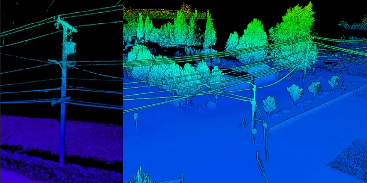
S&F performed aerial mapping and ground-based survey for a transmission line corridor and future substation. The transmission line survey encompassed a 6-mile corridor and utilized aerial LiDAR to capture detailed terrain, utility, and transmission-line features. The resulting point cloud was classified in accordance with client coding, with required meteorological conditions documented during LiDAR acquisition. For the future substation site, S&F completed an approximately 1.5-acre ALTA/NSPS Land Title and topographic survey, including the specified Table A items, utility coordination and mapping, and detailed surface data collection. The final deliverable included an ALTA Survey and a combined topographic survey base file of the substation and 6-mile alignment in required CAD format.
Project Details
MARKET
Utility
SERVICE
ALTA Surveys, Drone LiDAR and Aerial Imagery
LOCATION
Toquerville, UT